I know it isn't that obvious looking over the 11 days, and finding what made this the Tour de Suisse via hiking boots, but I am happy I came up with the idea, that I executed it, and when I was having difficult times starting, that I was able to push myself to stick to the plan
I am a little sad
It saddens me to know today was the last leg of the tour. I worked very hard over the past 11 days, and accomplished a lot. More than just hiking, more than just learning about cantons. And, more than just photographs. I have a clarity I didn't have 11 days ago about many things, and I am now able to have a better perspective on those things of which I reflected.
I am very proud
What an accomplishment!!! I started out with a strong long 16+ k hike in a beautiful part of Schwyz and ended today, on by far the most difficult hike, and I would dare say hardest climb I have ever done, in the beautiful Solothurn. This climb today, I knew it would be long and hard, but I never expected it to bee so long, and so hard... it was the perfect ending to the 11 days and I am so proud of myself for not giving up!!
Reflection
My goal at the start was to fill my off time. It turned into a lot of driving in the car, lots of rain on many days, and many opportunities to view Switzerland as I suspect, many have not seen her. This is an amazing and beautiful country and I DO feel like I won the lottery every single day I get up and look out my window, knowing where I now call home.
I hope all of you who are not from Switzerland will come for a visit. My home is always open and your are welcome. Just bring slippers and food money !!!
Ok.. on to the fun stuff
Sorry this is a bit shaky, but I was driving and thought to quickly capture a few video thoughts on my last day....
As I was getting closer in the car, I saw some cows and had to stop and say hello. I didn't get out of my car, but I was sure to have a memory of them.


Part I: On the hike
Note: there will be more pictures than usual
Total Hiking Time: 3 hours 40 minutes
Total Climbing Time: 2 hours
Starting Elevation: 2,270 feet
Highest Elevation: 4,543 feet
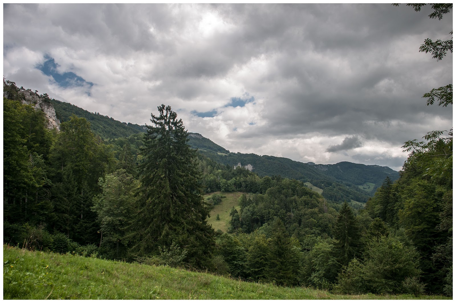
While driving in to the place where I was going to hike, I had a pretty good view of the mountain, the one I planned getting to the summit, which I did!!!
After seeing this, I was really getting geared up and excited. I think I was well prepared with the week and a half of hiking every day to have the legs and stamina to make it to the top


As I was starting the hike, I stepped into the woods real fast, and noticed it was snail central. They were everywhere. So, I took one quick shot with my Cooplix. I know it didn't turn out all that well, but trust me, they were all around.

Here is the hike route that I took, which was a total of 8.69 kilometers round trip. The funny thing is, even with google satellite I thought for sure, I would have an amazing view as I went up the ridge, but really, all I saw were lots of trees when I looked left.

Below is the altitude gain. I am hoping my friend Davin appreciates this, as I am certain he will. The main climb, which was essentially the only real climb, started right at my car, and continued for 2273 feet. What makes this more difficult is that this happened in just about 2.6 kilometers.

As some of you know, I have been to Nepal and climbed to much higher altitudes. One day, we went up somewhere around 4000-5000 feet and it was an all day hike. But, never was it this difficult. The climb today was extremely steep, but that was not the worst of it. There was a lot of deep mud in the fields and worse, in the woods, the trails were mostly exposed tree roots and very soft stone, which meant a lot of slipping. This, and anyone who has hiked in similar situations will tell you, causes one to work even harder to maintain balance, and not lose a footing.
In that picture above, I have shown the initial climb with the details, because of the appreciate I had for it. There were no switchback trails, it was generally straight up. To do this, and not just collapse is what I was most proud of today. I had my moments, like in the photo below where I wanted to just stop, but it would not have helped.

I stopped in a "flat" area to catch my breath, and when I was looking straight down, I noticed my eyes were two feet in front of my toes. This should give you an indication of how steep it was, even in the not so steep momentary rest spots. (you can try to ignore the gut getting into the picture... even it wanted to be famous)

As I was climbing up, a couple of things I didn't realize. Behind me, I could see the valley, but not where I came from, but in the middle and behind. It turns out, I was hiking up the right side of the ridge to the top, and when I went back down, I was on the other side of the mountain on the outside.
So, I used this opportunity to take a number of pictures to show how the valley was getting deeper and deeper in the distance. I am not sure if you can see that in the pictures, but, nevertheless, the views were fantastic.


In the middle of the climb somewhere, there were some goats grazing. They clearly got to roam very far, because no houses or barns were near, and they seemed to be loving their day.


When I was getting close to the top, there was an opening. I noticed a few things. The ground had two types of clay, a grey clay, and a tan clay. I thought that was pretty cool, as it was everywhere. The other thing was, it was like a mini bowl shape. I have no idea what formed that, maybe a meteor one day or something, but that was really interesting to look at.
I should also note, at the very top of the bowl, where I entered back into the trees, it got so steep, I was no longer walking, but climbing with hand holds.

I found my favorite sign posts at the top of the bowl, and a little plaque. I took a picture of it, but was exhausted from that last climb and didn't really care to clean it off enough for a solid picture that I could translate later. But, from looking at it, it is a notification of what to look out for in that area. I found a couple more of these as I was descending.


Once I got to the other side of the mountain I started my descend. I have to say, there were switchbacks, but they were very narrow, with a huge cliff and not nearly enough trees to keep me from going a long way. I also had a slip on a rock and sustained my only injury in 11 days, a scrape on my hand and it is swollen a bit. I will survive. But, I can tell you, that really slowed me down!!!
While heading down, I heard this loud snorting noise and a lot of crashing sounds. I looked up and a wild deer was hopping through this very steep mountain side like it was nothing. He had mud up to his knees and was clearly pissed with me being there. He stopped twice and snorted at me both times, then ran off. I tried to get a fast picture of him, but you may have a hard time finding him. Hint, he is in the middle area.

As I got into an opening, I took a couple of pictures of the view. To me, it was quite beautiful and I felt no need to let these be only for me.

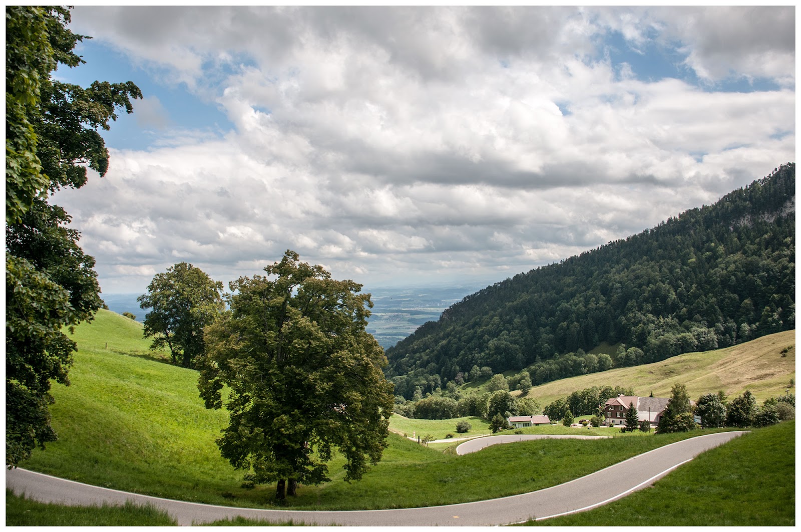
At this point in the hike, I was getting annoyed because it is very hard on the body to go down hill when it is steep. The distance I went up, I was now doing in reverse. Because the rest of the hike was on the street for 10 minutes, then a gravel road, there wasn't any grass to cushion the steps and the pounding went on and on and on.
In the middle of the hike down, I found there was a picture opportunity on the bends of the road in the woods.

There was also a water drop off from a stream. I made a panoramic of it, but I am not so certain it does the moment justice for multiple reasons. By the way, this is a vertical panoramic... is there legally such a thing allowed?!?!?!?!

The last part of the hike, does not include pictures, to which I am certain you will be glad.
I make it a habit to bring a change of clothing when hiking so I am not in the wet stuff for my car rides home. I have always done this. Today, I had shorts and a tee awaiting. Well, I decided to take it a step further and wash my body off a bit before I put them on. So, I went up the hill a bit as there was someone parked in a car close to mine, and I stripped down to only my personality. I was literally standing there as naked as naked gets, and frankly... I didn't care. I then took some bottled water I had left over, and dumped it on me slowly to wash down.
I felt so refreshed and good when I put the shorts and tee on... it is now a must on all trips.. and I will just tell the fan clubs to stare at will, but no pictures!!!!
Part II: The Balm Ruins
Before I go into too much detail, let me tell you this. Before the hike I was determined to see the ruins first. I figured I would be too tired afterwards. So, I started to hike up to them. Well, it wasn't really hiking, as there were steps. But, I got about half way up and got scared because of the height, how steep the steps were, the mini cliff off the side, and the instability of the surroundings. So, I turned around.
I was ashamed of myself for having done so, but, it really wasn't easy. So, for the last leg of the hike, I spent about 20 minutes psyching myself up to have another go.
I literally was repeating the mantra...
"Dave, you can do this. You will be fine. It isn't dangerous. Hold the rail and don't look out and you will have nothing to worry about. When you get to the to you will be so glad you did. And when you return to the bottom, you will certainly know you did the right thing."Repeating this to myself over and over really worked. I took it one step at a time, and I didn't look out, or up at any steps more than 4 or 5 in front of me. And I made it up. This picture doesn't fully indicate the poor quality of the steps, nor how steep they were and narrow. You also cannot see that there isn't really anything out to the left except air.

Down at the car parking lot level there was a lovely wall that was clearly part of the original structure. I took this picture at the start of the day, when I realized I didn't have the nerve to climb those steps.

From the road, here is what you could see of the ruins. It just looked like some stones with the Swiss flag hanging planted in the side of that wall of rock. Honestly, I thought this would have been the only picture that got shared. I am glad I was wrong and overcame a massive fear. A silly one at that!!!

Let me tell you a little bit about the Balm Ruins.
- They are the remains of a fortified cave dwelling at the foot of Balmfluh
- It is Solothurn's only cave stronghold and one of a very few in all of Switzerland
- The outer wall is 2.4 meters thick (8 feet)
- It doesn't look very big when one is standing at them, but it is impressive all of itself


I then climbed inside and took a couple of what it looked like from the inside, and of the town below.


On the way back down the steps, I saw a lizard. Actually, I saw a few, but decided it was a safe enough spot for me to take a memory home with me. He was kind as he could tell I was stressed, and so he waited until I got what I wanted before he moved on.

Part III: The Canton of Solothurn
Solothurn joined the federation in 1481, making it the 11th canton in Swtizerland. What I love about this is how it matched my theme of 11 hikes, 11 days, and 11 cantons, in chronological order, to their affinity for being the 11th canton.
Solothurn has, eleven historical fountains, eleven towers, eleven churches, and eleven chapels. At some point, I will map out each of these and visit them. Further, there is a local brewery named Öufi, which is Swiss German for 11, and they make a beer of the same name. You must visit their website, just to watch and listen to the glass get filled with beer.
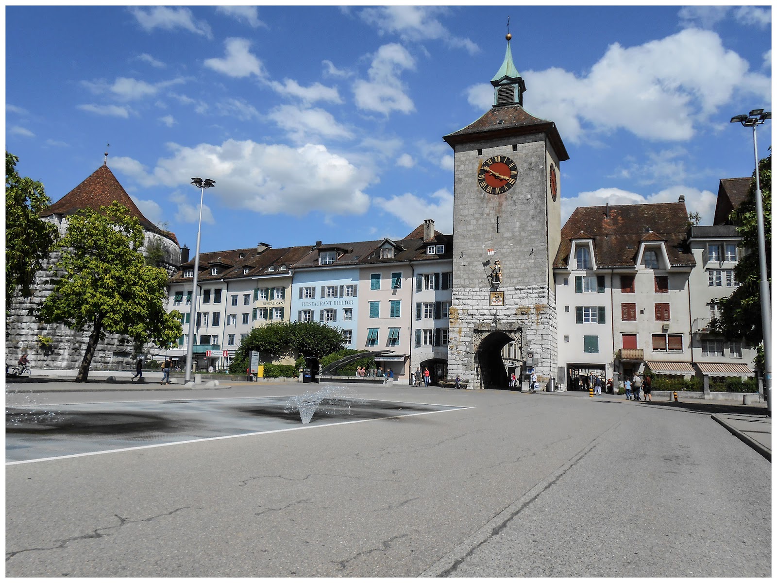
I had taken a few pictures in town, but somehow have misplaced all of them but this one.
Here is the final map addition for the 11 cantons hiked

Off Topic ... "a little bit"
While hiking, I could hear these cows mooing forever. So, when I finally got to them, I turned on the video so you could hear. Please try to ignore my massive heavy breathing as I as exhausted at this point, and in direct sunlight. Also, sorry for the smudge across the front, it was wet like all of me. Sadly, just as I stopped, they let out an amazing amount and very loud... oh well.


