Sunday, November 18, 2012

Day 16 Hike in Canton Appenzell Innerrhoden

This hike, Appenzell Innerrhoden (listen), no question, this was one of my favorite hikes since moving to Switzerland over a year ago. The trails were nice, the views were really fantastic, and it just made for an enjoyable day.

Part I: On to hiking


The hike started out a little odd because GPS could not find the address that I intended to stop. Also, there are so many very small villages, that even the locals do not know where some are (I had to ask directions at one point). But, I prevailed and found my destination and was all set. This little village reminded me of a trailer park, but, Swiss style. I am not sure what that means exactly, but I imagine the locals there enjoy living (or visiting on weekends) this spot very much.

Here is the parking lot where I started the hike. Just to the left there is a restaurant, and to the right (not really in the frame) is where some of the homes are. Behind me and to my left are many more, but, you will have to just take my word for it.


This hike was 10.7 kilometers long, and started out with a slow gradual climb. Then, the last leg of the climb was steep, though not as long. In total, starting out by going up a few hundred meters and a total elevation climb of 440 meters. Not the longest or hardest by any measure, but, really enjoyable for certain.

Below is the route of the hike. I mention this every time I hike, but, no hike ever turns out like I expect them to, because I never seem to get the map correct. If you follow the blue line to the right and down, when it gets to the bottom left, all was perfect. This was roughly the halfway point, and where I knew I would be making a turn. But, after about 1.5 kilometers, I decided to do a "Dave" and take my own route. This gave me the pleasure of spending about 3 kilometers in fields.

The route started out with these nice views, and beautiful valleys. There was even a small private helicopter sitting on a pad. On the second half of the hike, I saw it flying over.


The second picture here, which shows the wanderweg, also shows the trail to the left that I took. What it clearly doesn't demonstrate is how steep it was. Now, I am not implying it was vertical by any measure, but, it certainly wasn't as relaxing as the picture indicates.


As I got to the top, and looked out across the other side, I could see mountains, and only mountains for as far as I could see. Maybe a small cabin would be tucked in somewhere, but, really, it was just mountains and beauty.


Once getting to Scheidegg the views were still really beautiful. Unfortunately, these are the last of the scenic pictures I took, as I explained, I was a bit too busy exploring the cow fields for quite a while, almost literally got bit by a dog, took a long slide and almost ended up on my backside going down a road which had black ice, had to jump off the ledge of a dirt mound in the field, and, had the pleasure of stepping in some deep mud a few times.


Wouldn't trade any of that experience!!! :)

Finally, when back to what seemed to be a wanderweg, I stumbled by a farm. They had cows, but they looked cold and were inside, and some pigs. This particular one kept making noises to get my attention, and was seemingly excited to have me pay a visit. I didn't want to talk to him as I knew I would have an instant attachment, and knowing his fate, it would only make me much sadder.


Part II: About the canton


Unfortunately, other than that parking lot photograph at the top of this post, I do not have any historical pictures from the canton. I must admit, I was tired towards the end of the hike, a bit hungry, cold, and it was getting towards the end of the day.


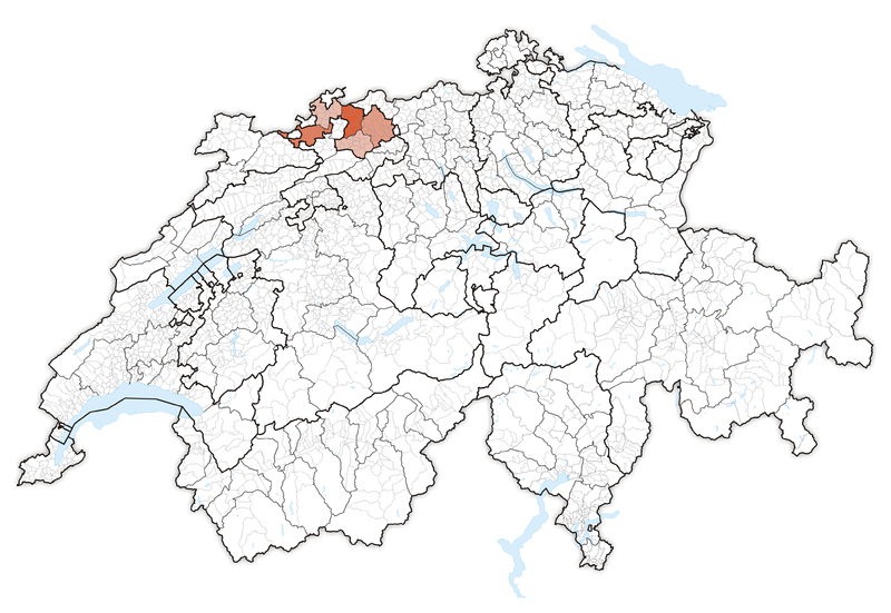
But, what I can tell you about this canton is that it's extremely small. I am guessing it is the smallest in Switzerland.

I do not have any historical facts that I will go on about here, because I mentioned some of them in the Day 15 Hike in Canton Appenzell Ausserrhoden posting, but, I will leave with one bit of information that I find very interesting, and, to be honest, hard to believe.

It wasn't until 1991 that, based on a Supreme Court decision, Appenzell Innerrhoden became the last canton in Switzerland to allow women the right to vote on local issues.  Am I the only one who finds this a bit off?

Day 15 Hike in Canton Appenzell Ausserrhoden

I enjoyed hiking in Appenzell Ausserhoden. (listen) and I suppose, by now, it is getting a bit boring to hear me say this, but, Switzerland is really beautiful and it seems, no matter where I go to hike, I always find a memory or two which makes it so enjoyable.  This canton is no different. 

Part I: On to hiking
The struggle with hiking in new places, is that one never knows (unless with someone who has already been there, or at least given advice) what to expect. This hike, was no different. I didn't know if it would be hard or easy, long or medium or short. The only thing I was pretty sure of, was that the weather forecast said it would be nice out.

The scene for this hike was to go through town, out to a lake, then up the side of a small mountain, which looped through the higher elevation of the town, and then back to the car where I started. That plan worked out perfectly. I didn't enjoy the first kilometer as it was on a road with no sidewalk. Luckily no cars came close, but, when there isn't any place to dive when things go awry, it isn't a comforting feeling.

The hike was only 8 kilometers long, and relatively flat, except for one climb of maybe 150-200 meters in total.  So, there wasn't any real strain for a hike, and really it could be considered more of a nice long walk I suppose.


What I love about hiking in places, even though the course may be simple enough, there is always something to bring home as a memory. The views along the way didn't disappoint, and while you will not see massive mountains, of valley's for as far as the eye can see, you will still find the beauty that makes it stand out on its own.

Here are a couple of pictures just as the hike got started. I never get bored with the beautiful, typical Swiss architecture.


Leaving town I took a look back and saw this nice view. It is funny, walking down the road it didn't look the same. Clearly, perspective changes everything.


Then, I was able to get into nature and enjoy the views of the woods. 


As always, I love the wanderweg signs that are posted through Switzerland. Here, I got an added bonus with the trestle tracks for the train that comes into Herisau. 


Once I got to the lake, there were many people walking around it. The water was nice to look at and it was a calming experience. With the leaves turning colour and falling to the ground, it makes for a perfect time to enjoy the surroundings.


Once crossing the halfway point and climbing to the top, I had a nice view looking over the lake, and, in a distance, I could see the city of Appenzell, which is in Canton Appenzell-Innerrhoden (see my next blog for that canton).

Here I was lucky enough to catch the passing train.

I don't have a good reason that I can use to explain why I love the cows so much, and, to date, I have been very lucky to see them most days. So, skip on down if you want to see different animals and not look at the cows again... Ok, we both know you won't skip the single picture :)


Then, I found some new friends... one looks a little like someone I know, but I won't say his name (baaaaAdam), and I will let you decide which one that is, and I am not saying "crazy eyes" to give it away


And my last view from the hike is of that trestle bridge again, but from the top, giving yet again, another perspective. I wonder, do the Swiss give so much thought to all of their architecture to create such beauty even in simple things???


Part II: About the canton
The capital of Appenzell Ausserhoden is Herisau. There are writings that go as far back as the year 837 talking about this down. It currently has a population of 15.174, which is seemingly a lot for what looks like a small city on the surface, but, when you drive through it going to Appenzell Innerrhoden, you get a much better perspective of its size.

Appenzell Ausserhoden is located on the eastern side of Switzerland.


The population of the entire canton is 53.313. The highest elevation point is Santis which is 8.209 feet, or, 2.502 meters. In 1513, Appenzell split into the two cantons because there was an increasing amount of conflicts between the Appenzell people and the abbot's agents.

Today, there are 6.959 foreigners living in this canton, which is just over 13% of the population.

Here are a couple of views of the town of Herisau. The first is a restaurant and the second is an older building with a nice view of the clock tower.

Sunday, November 4, 2012

Day 14 Hike in Canton Basel-Landschaft

Hiking in Basel-Landschaft was a lot of fun as I did it with a group of colleagues from work. Now, I will tell you before reading any further, I did start the hike in France and then crossed over into Basel-Landschaft. It wasn't clear to me at first if I could count this as the Basel-Landschaft hike but then realized, it doesn't matter where I start, as long as almost the entire hike (in this case, about 95%) is where it was meant to be. Further, it was a logical and easy meeting point for the group.

Part I: On to hiking

One of the things that never ceases to amaze me is how many people go hiking, but are not aware of what is about to happen. These sweet and kind colleagues came in sneakers, jeans, and had small bottles of water.

The hike was 14.3 kilometers long and started out with a solid climb of about 20 minutes. To add to this, there was mud on the trail some. It worried me for those less prepared, but, if we got into a pickle I would help them any way possible.

Before I go into more detail about the hike, I should point out, this is the first hike of the canton hikes that I started in one location and finished in another. Which is another reason why I started in France where I did, as it was a perfect spot to take the tram back to.

The total vertical climb of the hike is 430 meters with most of it right at the start. Then, there were a couple of gradual climbs.

Here is the hiking map. As you can see, there are two locations.


The hike was based on a theme of visiting castles. So, as soon as we got to the top of the first climb, we came about castle number one.
I will edit this posting when I gather the details of the castles. It has been a bit of time since the hike.

This first picture is of those who came hiking with me at the top. I was too afraid to climb the scary steps, but they did .. and were all glad as they said the views were amazing!!!

This castle gave so many great opportunities for fantastic photos. I could stay there all day shooting in the morning as the sun comes up, afternoon with full light, or as it settles for the day. It is a must visit if you are in the area. I am not sure if you can drive up to it, but I do know there are roads close by (which we didn't take).


After climbing to the top of that mountain, and visiting the castle, we came into a small village, which was really beautiful as well. They also had a fruit stand based on the honor system. Knowing this is how my parents run their farm, nothing gave me greater pleasure to see. And yes, I bought a box of plums.

This photo is of a church at the corner of the village... really beautiful. I didn't go inside, but just from the outside, it was clearly impressive in size, architecture, it's age, and how well kept it is.


The second castle we came to, is actually used today. According to one of the hikers in our group (he lives in the area, is very smart, and knows all of the history), it is used in the summer time as a hostel. Pretty cool.

Here are a couple of pictures of that castle. I took many more, but didn't want to give away too much, as my hope is you will come and visit for yourself.


Here is the castle off in a distance... actually, I took this before I took the two above, as it was on the way to the castle, but, I do not think you will sue me for reversing the order.


Here is a picture as we headed into the woods, which was towards the third and final castle. You will notice there are no pictures of that castle because we couldn't find it. At most, we were expecting a foundation, but not even that became clear to the eyes... For the record, we were in the right area!! :)


I know it gets old for me to say this, but, really, would there be a hike without a visit of cows? I do not know why I love cows so much. But, I find them to be friendly and gentle given their stature. What is interesting about this photo is, way in the background you will see a small mountain, just off left center. In the middle of that you will see a tan coloured dot. That is the first castle we visited. This should give you a sense of the distance we traveled.


Part II: About the canton
I am sorry to say I do not have any city pictures to post, nor an informational maps to share. But, I will provide you with some statistics and other details which should tell you a little bit about Canton Basel-Landschaft.

As you can see, it is one of the cantons that touches France. It isn't one of the largest, and has an odd shape to it, which, I might add makes it difficult to map out hikes if trying to stay completely within the canton. Yes, it can be easily done, but takes extra caution to navigation.


Basel-Landschaft was founded in 1501 as part of  Basel-Stadt, then in 1833 became it's own canton. There was an uprising in 1833 which caused the split within Basel called the Battle of the Hülftenschanz.

Allschwil is the largest city and Liestal is the capital. The total population of Basel-Landschaft is 277.042. The highest elevation is 1.169 meters.

If you would like to go to the official Basel-Landschaft website, follow this link.

What I can say, in closing about Basel-Landschaft is that it has amazing views almost everywhere. There are mountains and rolling hills. Lovely little towns and the locals are very, very nice. I highly recommend a hike here when you get the chance. And, if you do, let me know, I would love to come along!