Part I: On to hiking
One of the things that never ceases to amaze me is how many people go hiking, but are not aware of what is about to happen. These sweet and kind colleagues came in sneakers, jeans, and had small bottles of water.
The hike was 14.3 kilometers long and started out with a solid climb of about 20 minutes. To add to this, there was mud on the trail some. It worried me for those less prepared, but, if we got into a pickle I would help them any way possible.
Before I go into more detail about the hike, I should point out, this is the first hike of the canton hikes that I started in one location and finished in another. Which is another reason why I started in France where I did, as it was a perfect spot to take the tram back to.
The total vertical climb of the hike is 430 meters with most of it right at the start. Then, there were a couple of gradual climbs.
Here is the hiking map. As you can see, there are two locations.

I will edit this posting when I gather the details of the castles. It has been a bit of time since the hike.
This first picture is of those who came hiking with me at the top. I was too afraid to climb the scary steps, but they did .. and were all glad as they said the views were amazing!!!

This castle gave so many great opportunities for fantastic photos. I could stay there all day shooting in the morning as the sun comes up, afternoon with full light, or as it settles for the day. It is a must visit if you are in the area. I am not sure if you can drive up to it, but I do know there are roads close by (which we didn't take).


After climbing to the top of that mountain, and visiting the castle, we came into a small village, which was really beautiful as well. They also had a fruit stand based on the honor system. Knowing this is how my parents run their farm, nothing gave me greater pleasure to see. And yes, I bought a box of plums.
This photo is of a church at the corner of the village... really beautiful. I didn't go inside, but just from the outside, it was clearly impressive in size, architecture, it's age, and how well kept it is.

The second castle we came to, is actually used today. According to one of the hikers in our group (he lives in the area, is very smart, and knows all of the history), it is used in the summer time as a hostel. Pretty cool.
Here are a couple of pictures of that castle. I took many more, but didn't want to give away too much, as my hope is you will come and visit for yourself.


Here is the castle off in a distance... actually, I took this before I took the two above, as it was on the way to the castle, but, I do not think you will sue me for reversing the order.

Here is a picture as we headed into the woods, which was towards the third and final castle. You will notice there are no pictures of that castle because we couldn't find it. At most, we were expecting a foundation, but not even that became clear to the eyes... For the record, we were in the right area!! :)

I know it gets old for me to say this, but, really, would there be a hike without a visit of cows? I do not know why I love cows so much. But, I find them to be friendly and gentle given their stature. What is interesting about this photo is, way in the background you will see a small mountain, just off left center. In the middle of that you will see a tan coloured dot. That is the first castle we visited. This should give you a sense of the distance we traveled.

Part II: About the canton
I am sorry to say I do not have any city pictures to post, nor an informational maps to share. But, I will provide you with some statistics and other details which should tell you a little bit about Canton Basel-Landschaft.
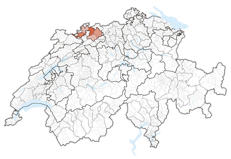
As you can see, it is one of the cantons that touches France. It isn't one of the largest, and has an odd shape to it, which, I might add makes it difficult to map out hikes if trying to stay completely within the canton. Yes, it can be easily done, but takes extra caution to navigation.
Basel-Landschaft was founded in 1501 as part of Basel-Stadt, then in 1833 became it's own canton. There was an uprising in 1833 which caused the split within Basel called the Battle of the Hülftenschanz.
Allschwil is the largest city and Liestal is the capital. The total population of Basel-Landschaft is 277.042. The highest elevation is 1.169 meters.
If you would like to go to the official Basel-Landschaft website, follow this link.
What I can say, in closing about Basel-Landschaft is that it has amazing views almost everywhere. There are mountains and rolling hills. Lovely little towns and the locals are very, very nice. I highly recommend a hike here when you get the chance. And, if you do, let me know, I would love to come along!
No comments:
Post a Comment